Six maps of the Tehran and Suburbs in Qajar period (1848 to 1925).
(Source: Nimrooz) – To see the details in the maps click on the images, hold down your mouse button, and move the pointer over the image.
The earliest map of Tehran, Fath-Ali Shah Qajar period (1826)
Created by Naskov, Russian military officer, 1826 – From the book “Visual Documentations of Iranian Cities” by Mohammad Mehryar and others. Tehran, Shayid Beheshti University, Page 147.

The second map of Tehran, Mohammad Shah Qajar period (1848)
by Brezin

The third map of Tehran, Mohammad Shah Qajar period (1858)
by August Křziž (Austrian)

Map of Tehran, Nasereddin Shah Qajar period (1891)
by Abdol-Ghaffar Khan Najmol Molk

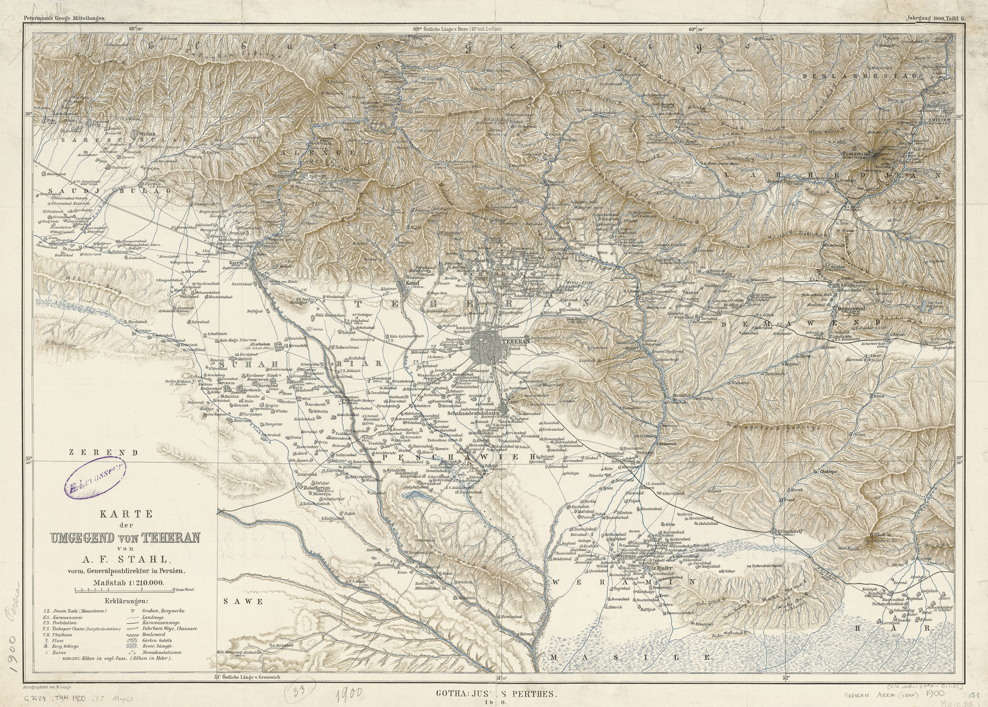
Map of Tehran, Mozaffareddin Shah Qajar period (1900)
by Alexander Friedrich Stahl
Map of private schools in Tehran, Ahmad Shah Qajar period (~1920-1925)
by Ministry of Culture

✤ Also available in: Persian